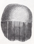
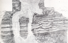
Hutton’s journeys to prove his theory took him to Glen Tilt, Southwest Scotland and Arran with the purpose of demonstrating that granite was young, igneous rock and not of ancient origin. He had such a thorough knowledge of the geology of the British Isles he
estimated accurately where to find what he was looking for. He found exposed on the River Tilt the contact point between granite and its surrounding rock; the granite had broken the edges of the surrounding marble and penetrated deeply into it – proving it was both intrusive and younger than the surrounding rock and not of ancient origin.
The following summer they journeyed south-west to examine the granite of Galloway and its junction with the older sedimentary rocks of the Southern Uplands. The following year in 1787, Hutton went to Arran to study “the nature of granite and the connection of it with the contiguous strata”. Here he made additional observations to strengthen proof of this theory, that of the power of the sea to erode whole land-masses.
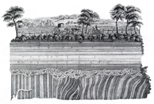
Later that year, he made a chance but important discovery whilst visiting his friend John Davidson of Stewartfield near Jedburgh in the Scottish Borders. In the exposed sheer banks of the River Jed across the water from Allar’s Mill, he noticed the sedimentary sandstone rock-layers lying horizontally over vertical layers of greywackes (and shale), with a thin layer between them of a conglomeration of material from the lower rock-layers of greywackes. The significance of this (now known as an unconformity), was the two different rock layers lying at angles and not parallel to each other.
Hutton deduced that the greywacke and shale, having been deposited on the sea bed as muds and clays, were than physically folded and elevated above the surface of the sea. This was followed by exposure to erosion, which removed the curve at the apex of the fold, leaving the vertical layers, before the land sank to be re-submerged by the sea. A second phase of sedimentation and compaction of sands, took place on the ocean floor before a second elevation to form a new land-mass took place. This process could only have been possible given a gigantic time-scale, proving Hutton’s proposition of the ancient age of the Earth.
Hutton typically sought verification of this observation through other examples in other places. The following year, knowing what he was looking for, he made a journey by boat along the foot of the Berwickshire cliffs not far from his farm at Slighhouses.
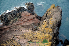
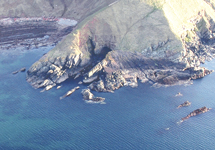
“Having taken boat at Dunglass Burn, we set out to explore the coast”, writes James Hutton of his trip with his friends John Playfair and James Hall from nearby Dunglass, to find further the proof for his theory….and this they did “At Siccar Point”, he wrote “…we found a beautiful picture of this junction washed bare by the sea”. Here Hutton and his colleagues found the same junction of the same rock layers as those at Jedburgh; the horizontal sandstone rock-layers extensively eroded by the sea, exposing in parts, the vertical ends of the more resistant greywacke which are left protruding above it.
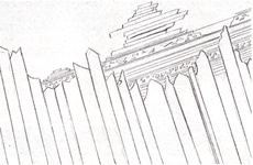
Siccar Point validated and clarified the unconformity in Jedburgh, providing the defining proof for Hutton’s Theory of the Earth. John Playfair, deeply moved by the significance of what they observed wrote later “The palpable evidence presented to us, of one of the most extraordinary and important facts in the natural history of the earth, gave a reality and substance to those theoretical speculations, which, however probable, had never till now been authenticated by the testimony of the senses…What clearer evidence could we have had of the different formation of these rocks, and of the long interval which separated their formation, had we actually seen them emerging from the bosom of the deep? … The mind seemed to grow giddy by looking so far into the abyss of time”.